To count towards the proven Five Year Housing Land Supply, the planning approval must refer to land that meets certain criteria

Here are the key points to consider


  • The land must be deliverable within the five-year period. This means that there should be a realistic prospect that housing will be delivered on the site within this timeframe.
  • Evidence of deliverability might include site assessments, planning status, and infrastructure availability.
Infrastructure:

While the exact requirements can vary, generally, for a site to be considered deliverable, it should have access to essential infrastructure, or there should be a clear and feasible plan for providing it.

This includes:

- Access Roads: There should be suitable access to the site for construction and future residents. If an access road is not already in place, there should be a clear plan and commitment to building one.

- Utilities (Media): The site should have, or be capable of having, essential utilities such as water, electricity, gas, and sewage systems. If these services are not yet connected, there should be clear, feasible plans and commitments to provide them.

While the local planning authority ensures that sites included in the Proven Five Year Housing Land Supply are deliverable and have the potential for development, the actual provision of infrastructure such as roads and utilities is typically the responsibility of the developer, often secured through planning conditions or obligations.

To ensure that infrastructure is provided, local planning authorities can use planning obligations, also known as Section 106 agreements, to require developers to contribute to or directly provide necessary infrastructure as part of their planning permission. These agreements can stipulate that certain infrastructure must be in place before development can proceed or before any homes can be occupied.

  • The site must be suitable for housing development. This involves compliance with local planning policies and alignment with the broader strategic housing objectives.
  • Suitability also takes into account environmental constraints, access to amenities, and infrastructure capacity.
  • The land must be available for development now. There should be no legal or ownership barriers that would prevent development from commencing.
  • Availability may be demonstrated through landowner agreements or developer commitments.
  • The development on the site must be achievable within the five-year period. This includes financial viability and the likelihood of obtaining necessary planning permissions.
  • Achievability also considers market demand and the developer’s track record in delivering similar projects.
  • The proposal should support the objectives of the NPPF, such as promoting sustainable transport, high-quality design, and climate change mitigation.
  • The planning approval should consider the impact on the local community and environment. This includes preserving the character of the area, protecting green spaces, and mitigating adverse effects.
  • Public consultation and environmental assessments are critical components in evaluating these impacts.

Conclusion


For a planning approval to count towards the proven Five Year Housing Land Supply, it must demonstrate that the land is deliverable, suitable, available, achievable, and compliant with NPPF guidelines. Ensuring these criteria are met is essential for maintaining a robust and effective housing supply strategy that balances development needs with community and environmental considerations.


Water Butts

Water butts are large containers designed for collecting and storing rainwater, typically from the roof via downpipes. This stored water can then be used for various purposes, primarily in gardening and landscaping, to reduce the use of mains water.

Key Features and Benefits


  • Water butts are connected to the downpipes of a building’s guttering system to collect rainwater runoff.
  • They come in various sizes and shapes, typically ranging from 100 to 300 litters, although larger ones are available.
  • The collected rainwater is primarily used for watering plants, lawns, and gardens.
  • It can also be used for cleaning purposes, such as washing cars or outdoor surfaces.
  • Reduces demand on mains water supply and helps lower water bills.
  • Using a water butt helps conserve water, especially during dry periods or droughts.
  • It contributes to sustainable water management practices.
  • Reduces the volume of runoff entering the drainage system, which can help prevent flooding and reduce the burden on sewer systems.

Installation and Maintenance


  • Typically placed near the downpipe of a roof guttering system.
  • Often comes with a tap or spigot at the bottom for easy water access.
  • Can be connected to other water butts to increase storage capacity.
  • Regularly check for debris that might block the inlet.
  • Clean the interior occasionally to prevent algae and mosquito breeding.
  • Ensure that the lid is secure to keep out leaves and pests.

Water butts are a practical and environmentally friendly way to conserve water, especially useful for gardeners and those looking to reduce their environmental footprint.

Sources


Defra Biodiversity Metric 3.0

Defra Biodiversity Metric 3.0 is a tool developed by the UK Department for Environment, Food & Rural Affairs (Defra) and Natural England to measure and account for biodiversity losses and gains resulting from development or changes in land management. This metric is crucial for ensuring that new developments achieve Biodiversity Net Gain (BNG), meaning they leave the natural environment in a better state than before.

Key Features and Usage


  • The metric helps assess the existing biodiversity value of a site before any development.
  • It quantifies the number of biodiversity units present in various habitat parcels within the site.
  • It evaluates the impact of development on biodiversity, calculating the expected losses and gains in biodiversity units.
  • This includes considering both on-site and off-site habitat creation or enhancement.
  • The metric incentivises creating and enhancing habitats where they are most needed to improve ecological networks.
  • It rewards early action by landowners who create or enhance habitats in advance.
  • Updated and simplified approaches are used to assess the condition of habitats, ensuring accurate valuation.
  • The tool allows professional ecologists to apply their judgment if the standard scores do not reflect the true value of a habitat parcel.
  • The metric is used throughout the planning and development process to ensure that biodiversity gains are considered and achieved.
  • It supports the legal requirement under the Environment Bill for developments to achieve at least a 10% net gain in biodiversity.

Implementation and Benefits


Developers use the metric to plan and demonstrate how their projects will achieve BNG, either through on-site improvements or off-site compensatory measures.

Ecologists utilize the metric for accurate biodiversity assessments and to guide habitat management decisions.

Local Planning Authorities ensure compliance with BNG requirements by incorporating the metric into their planning processes.

By providing a standardised, transparent method for measuring biodiversity, the Defra Biodiversity Metric 3.0 plays a critical role in enhancing environmental sustainability in urban and rural development.

Biodiversity Net Gain (BNG)

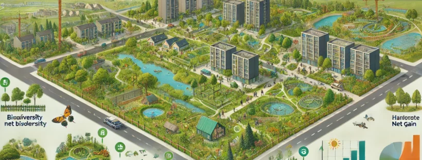
Biodiversity Net Gain (BNG) is a principle and practice within environmental management and planning aimed at ensuring that development projects leave the natural environment in a measurably better state than it was before. This concept focuses on enhancing habitats and ecosystems, thereby increasing biodiversity rather than just mitigating harm.

Key Components of Biodiversity Net Gain


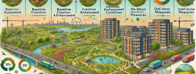
Baseline Assessment: Conducting an initial assessment to understand the existing biodiversity and ecological value of a site before development.

Quantitative Metrics: Using standardized metrics to measure biodiversity losses and gains. In the UK, the Defra Biodiversity Metric 3.0 is often used for this purpose.

On-site Measures: Enhancing existing habitats or creating new ones within the development site.

Off-site Measures: Implementing biodiversity enhancement projects at different locations if on-site measures are insufficient.

Management Plans: Developing and implementing long-term management and monitoring plans to ensure that biodiversity gains are sustained over time.

Legal and Financial Mechanisms: Ensuring that legal agreements and financial arrangements are in place to support ongoing biodiversity management.

Community and Expert Involvement: Engaging local communities, ecologists, and other stakeholders in the planning and implementation process to ensure the measures are appropriate and effective.

Benefits of Biodiversity Net Gain


Enhances habitats, supports species recovery, and increases ecosystem resilience.

Can enhance property values, reduce regulatory risks, and provide marketing advantages for developers.

Improves quality of life by creating green spaces and promoting well-being.

Implementation in Policy


Many countries are integrating BNG into their planning policies. For example, in the UK, the Environment Act 2021 mandates that new developments must deliver at least a 10% net gain in biodiversity, calculated using the Defra Biodiversity Metric 3.0.

Sources


Sustainable Drainage Systems (SuDS)

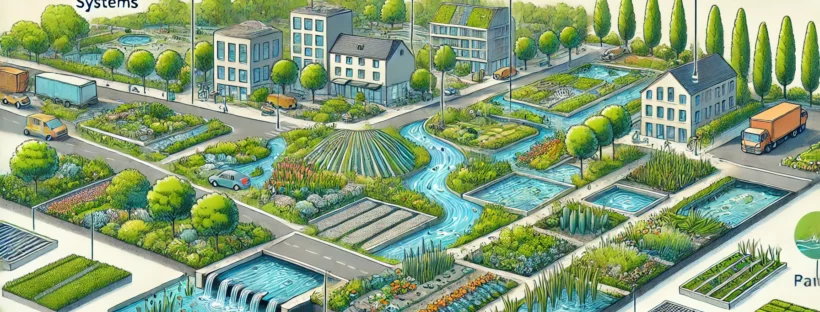
Sustainable Drainage Systems (SuDS) are a collection of water management practices designed to mitigate the adverse effects of urban stormwater runoff and promote the natural water cycle. The primary objectives of SuDS are to manage surface water sustainably, enhance water quality, and provide amenity and biodiversity benefits.

Key Components and Objectives of SuDS


SuDS aim to manage surface water runoff close to where it falls and mimic natural drainage as closely as possible. This involves techniques such as infiltration, storage, and slow release of water to reduce flood risk.

By filtering pollutants from runoff, SuDS help to improve the quality of water entering rivers, lakes, and other water bodies. This can be achieved through natural filtration processes involving vegetation and soil.

SuDS can create attractive environments and habitats for wildlife. Features such as green roofs, ponds, wetlands, and swales can enhance the local environment, providing recreational spaces and supporting biodiversity.

Common SuDS Techniques


Allows water to infiltrate through the surface into the ground, reducing runoff.

Vegetated roof systems that absorb rainwater, provide insulation, and support biodiversity.

Shallow, vegetated channels that slow and filter runoff.

Planted areas that collect and absorb rainwater from roofs, driveways, and streets.

Bodies of water designed to store runoff, enhance water quality, and provide wildlife habitats.

Benefits of SuDS


By controlling the flow and volume of surface water, SuDS help reduce the risk of flooding.

Natural filtration processes improve the quality of water before it enters watercourses.

SuDS provide green spaces, enhance urban aesthetics, and support local ecosystems.

SuDS contribute to climate adaptation by managing the impacts of extreme weather events.

These systems are essential for managing water in urban environments, ensuring that development is sustainable and resilient to climate change.

Sources


Criteria for Referring Applications to the Planning Committee


In many local planning authorities, including East Hampshire District Council (EHDC), certain types of planning applications are indeed referred to the Planning Committee rather than being decided by planning officers under delegated powers.

This typically includes larger and more controversial developments, such as those that are outside settlement boundaries or involve a significant number of new houses. Here’s how this works:

Criteria for Referring Applications to the Planning Committee


  • Large Developments: Applications involving a significant number of new houses (such as over 50) are often referred to the Planning Committee due to their potential impact on the local area.

  • Outside Settlement Boundaries: Developments proposed outside the designated settlement boundaries are likely to be scrutinized more closely, especially if they involve substantial construction, as these areas are usually protected by local planning policies to control urban sprawl and preserve the character of the countryside.
  • High Public Interest: Applications that generate a large number of public comments or objections are more likely to be considered by the Planning Committee.

  • Controversial Developments: Projects that are contentious or have significant local opposition may also be referred to the Committee to ensure a transparent decision-making process.
  • Policy Deviations: Proposals that do not fully comply with local or national planning policies may require Committee consideration to carefully weigh the benefits and impacts.

  • Sensitive Areas: Developments affecting sensitive areas such as green belts, conservation areas, or sites with environmental or historical significance are typically referred to the Committee.

Planning Committee Process


  • Preparation: The planning officers prepare a report for the Planning Committee, summarizing the application, relevant policies, consultation responses, public comments, and a recommendation.
  • Publication: The agenda for the Committee meeting, including the report and recommendations, is published in advance.
    • Notification: Stakeholders, including those who have submitted comments, are notified about the meeting.
    • Speaking Rights: Members of the public can register to speak at the meeting to present their views.
    • Presentation: The planning officer presents the report and recommendation.
    • Public Input: Registered speakers present their comments.
    • Debate and Decision: Councillors debate the application and make a decision by voting.

    Delegated Powers


    • Routine Applications: Smaller and less controversial applications are often decided by planning officers under delegated powers to streamline the process.
    • Criteria for Delegation: The criteria for delegation and Committee referral are typically set out in the Council’s Constitution or Scheme of Delegation.

    Specific Policy for EHDC


    For East Hampshire District Council, the specific criteria for referring applications to the Planning Committee can be found in their local planning policies and procedural documents. It is common for larger developments, especially those outside settlement boundaries and involving a significant number of houses, to be referred to the Planning Committee.

    Conclusion


    In summary, applications for developments over 50 houses or those outside settlement boundaries are typically referred to the Planning Committee rather than being decided by planning officers under delegated powers due to their potential impact and the level of public interest.

    Public Rights of Way (PRoW)


    Public Rights of Way (PRoW) in the UK are legally protected pathways that allow the public to travel across private and public land. They form an important part of the country’s transport infrastructure and cultural heritage, providing access to the countryside and urban green spaces. There are several types of public rights of way, each with specific legal definitions and uses:

    • Description: Paths on which the public has a right to walk.
    • Usage: Walking, running, mobility scooters, and pushchairs.
    • Legal Definition: A way over which the public has a right of way on foot only.

    • Description: Paths on which the public has a right to walk, ride horses, and cycle.
    • Usage: Walking, horse riding, and cycling (cyclists must give way to walkers and horse riders).
    • Legal Definition: A way over which the public has a right of way on foot, horseback, and with bicycles.

    • Description: Paths open to all types of traffic, including motor vehicles.
    • Usage: Walking, horse riding, cycling, and motor vehicles.
    • Legal Definition: A way over which the public has a right of way for all traffic, but which is used mainly for walking, horse riding, and cycling.

    • Description: Paths on which the public has a right to walk, ride horses, cycle, and use non-motorized vehicles.
    • Usage: Walking, horse riding, cycling, and horse-drawn carriages.
    • Legal Definition: A way over which the public has a right of way on foot, horseback, bicycle, and by non-motorized vehicles.

    Legal Framework


    The rights of way network is protected and maintained under several pieces of legislation, including:

    Governs the creation, maintenance, and management of public rights of way.

    Provides additional protections and public access rights.

    Establishes the framework for designating National Parks and Areas of Outstanding Natural Beauty (AONBs) and maintaining rights of way.

    Management and Maintenance


    Public rights of way are managed by local authorities, typically county councils or unitary authorities. They are responsible for:

    Ensuring paths are clearly marked and accessible.

    Keeping paths clear of obstructions and ensuring the surface is suitable for its intended use.

    Preventing illegal obstructions or changes to the paths.

    Importance and Benefits


    Public rights of way provide numerous benefits:

    They offer spaces for walking, running, cycling, and horse riding, promoting physical health and well-being.

    They allow access to natural landscapes and promote conservation efforts.

    They preserve historical routes and contribute to the cultural landscape.

    They support local economies by attracting tourists and outdoor enthusiasts.

    FP18 and FP19


    The references “FP18” and “FP19” specifically pertain to public footpaths numbered 18 and 19 in the local area. Public footpaths are designated paths that provide public right of way on foot, often through rural or semi-rural areas. These footpaths are typically managed by local authorities and are crucial for providing pedestrian access to various amenities and recreational areas.

    In the context of the objection document, the mention of “FP18” and “FP19” indicates specific public footpaths that will be materially impacted by the proposed development. Here is what it means in detail:


    PRESUMPTION IN FAVOUR OF SUSTAINABLE DEVELOPMENT (NPPF PARAGRAPH 11)


    • Presumption in Favour of Sustainable Development: According to the National Planning Policy Framework (NPPF), there is a presumption in favour of sustainable development. This means that planning permission should be granted unless the adverse impacts of doing so would significantly and demonstrably outweigh the benefits when assessed against the policies in the NPPF as a whole.
    • Lack of Five-Year Housing Land Supply: If a local authority cannot demonstrate a five-year supply of deliverable housing sites, the policies in the Local Development Plan that are most relevant to housing supply are considered out-of-date. In such cases, the presumption in favour of sustainable development is particularly relevant.


    Rural Planning: Approvals Outside Local Development Plans and Settlement Boundaries

    Planning applications outside the Local Development Plans and settlement boundaries in rural England can be approved based on several key factors:


    • Economic Benefits: The economic benefits of the proposed development, such as job creation, increased local spending, and contributions to local infrastructure, can be significant factors in the decision-making process.
    • Social Benefits: The provision of housing, particularly affordable housing, and the support of local services and facilities can be crucial considerations.
    • Environmental Benefits: Enhancements to biodiversity, sustainable drainage systems, and the overall environmental sustainability of the development can be key factors.

    • High-Quality Design: Developments that are of high architectural and design quality and that contribute positively to the character of the area may be approved.
    • Sustainability: Proposals that include sustainable building practices, renewable energy sources, and other green technologies can be viewed favourably.

    • Local Needs: In some cases, developments may be approved if they meet specific local needs, such as housing for agricultural workers or the provision of community facilities.
    • Community Support: Demonstrated support from the local community can also be a factor, particularly if the development addresses specific local issues or needs.
    • Presumption in Favour of Sustainable Development: According to the National Planning Policy Framework (NPPF), there is a presumption in favour of sustainable development. This means that planning permission should be granted unless the adverse impacts of doing so would significantly and demonstrably outweigh the benefits when assessed against the policies in the NPPF as a whole.
    • Lack of Five-Year Housing Land Supply: If a local authority cannot demonstrate a five-year supply of deliverable housing sites, the policies in the Local Development Plan that are most relevant to housing supply are considered out-of-date. In such cases, the presumption in favour of sustainable development is particularly relevant.
    • Appeal Decisions: Previous planning appeal decisions can set precedents that influence future decisions, particularly if the circumstances are similar.
    • Precedents: Approval of similar applications in the area or under similar circumstances can also play a role.

    Isolated Homes in the Countryside: Paragraph 79 of the NPPF allows for the approval of isolated homes in the countryside under certain circumstances, such as if the development would:

    • Represent the optimal viable use of a heritage asset.
    • Re-use redundant or disused buildings and enhance their immediate setting.
    • Be of exceptional quality or innovative design.


    Planning Application 55318/001: Land west of Beechlands Road, South Medstead, Alton

    Work In Progress
    —-
    Proposal: 70 Dwellings with Vehicular Access
    Case Officer: Samantha Owen
    Developer: Bargate Homes

    Planning Application 27000/005: Land to the rear and including Fair Winds, 61 Lymington Bottom Road, Medstead, Alton

    Work In Progress
    —-
    Proposal: 53 Dwellings with Vehicular Access
    Case Officer: Samantha Owen
    Developer: Bewley